

21 Feyregger Rundwanderweg


- pets allowed
- culinary interesting
- Flatly
- Possible accommodation
Interactive elevation profile
Create PDF
Tour-Details
Starting place: 4540 Bad Hall
Destination: 4540 Bad Hall
duration: 2h 30m
length: 9,2 km
Altitude difference (uphill): 133m
Altitude difference (downhill): 133m
Lowest point: 355m
Highest point: 444m
difficulty: easy
condition: easy
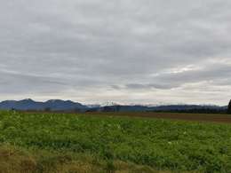
panoramic view: Great panorama
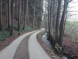
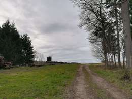
Paths covering:
Asphalt, Gravel, Hiking trail
powered by TOURDATA
Eduard-Bach-Straße (Museum Forum Hall) - Tassiloquelle - Pfarrkirchner Straße - Kirchenplatz - Volksschule - Kalvarienberg - Urbamühle - Güterweg Schachner - Waldweg zum Großortner - Dehenwanger Straße - Waldweg zum Großortner - Dehenwanger Straße - Wiesenweg entalng Golfplatz - Ranwallner Straße - Feyregger Straße - Schwimmbadstraße - Tassiloquelle - Eduard-Bach-Straße.
Destination: Kneipp facility, panoramic view.
Panorama square: Haiding.
Tip: Pfarrkirchen rococo church, monuments.
Refreshment stop: Ristorante Castello in Mühlgrub Castle. Eduard-Bach-Straße (Museum Forum Hall) - Tassiloquelle - Pfarrkirchner Straße - Kirchenplatz - Volksschule - Kalvarienberg - Urbamühle - Güterweg Schachner - Waldweg zum Großortner - Dehenwanger Straße - Waldweg zum Großortner - Dehenwanger Straße - Wiesenweg entalng Golfplatz - Ranwallner Straße - Feyregger Straße - Schwimmbadstraße - Tassiloquelle - Eduard-Bach-Straße.
Destination: Kneippanlage, panoramic view.
Panoramaplatz: Haiding.
Tip: Rococo church Pfarrkirchen, monuments.
Refreshment stop: Ristorante Castello in Mühlgrub Castle.
- Suitable for groups
- Suitable for schools
- Pets allowed
- Spring
- Summer
- Autumn
Please get in touch for more information.
Kurpromenade 1
4540 Bad Hall
Phone +43 7258 7200
Fax machine +43 7258 7200 - 20
E-Mail info@badhall.at
Web www.badhall.at
http://www.badhall.at
")
")
Interactive elevation profile
Create PDF
Tour-Details
Starting place: 4540 Bad Hall
Destination: 4540 Bad Hall
duration: 2h 30m
length: 9,2 km
Altitude difference (uphill): 133m
Altitude difference (downhill): 133m
Lowest point: 355m
Highest point: 444m
difficulty: easy
condition: easy
panoramic view: Great panorama
Paths covering:
Asphalt, Gravel, Hiking trail
powered by TOURDATA