Kubin Kunst- und Naturweg am Unteren Inn
Starting place: 4780 Schärding
Destination: 4780 Schärding
The wild and romantic nature and landscape of the Lower Inn Valley between the baroque town of Schärding and the charming three-river town of Passau is unique and fascinating.
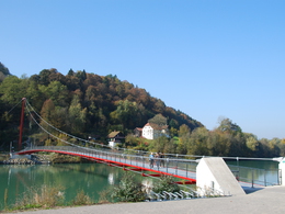
The picturesque and interesting places are just as impressive and interesting. Take a short round trip in the footsteps of Alfred Kubin, by water or on land. This trail leads from Schärding over the Old Inn Bridge to Neuhaus, on to Neuburg, over the Mariensteg to Wernstein and back to Schärding. The interesting information boards allow you to immerse yourself in the world of the famous painter and graphic artist Alfred Kubin. An experience for hikers, cyclists and Kubin fans. Starting place: 4780 Schärding
Destination: 4780 Schärding
duration: 2h 31m
length: 9,6 km
Altitude difference (uphill): 140m
Altitude difference (downhill): 11m
Lowest point: 305m
Highest point: 438m
difficulty: easy
condition: medium
panoramic view: Great panorama
Paths covering:
Asphalt, Gravel
further information:
- Flatly
- Possible accommodation
- Board possible
Details - hiking
- themed path
Payment methods
Cash payment
- Suitable for groups
- Suitable for schools
- Suitable for single travelers
- Suitable for families
- Suitable for friends
- Suitable for couples
- Spring
- Summer
- Autumn
Please get in touch for more information.
Innbruckstraße 29
4780 Schärding
Phone +43 7712 4300 - 0
Fax machine +43 7712 4320
E-Mail info@schaerding.info
Web www.schaerding.at
http://www.schaerding.at


