Augenbründlweg
Path number: Nr. 96
Starting place: 4282 Pierbach
Destination: 4282 Pierbach
Dorfstraße 22
4282 Pierbach
4282 Pierbach

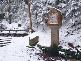
Augenbründlweg No. 96 - the Augenbründl is dedicated to St. Ottilie, the patron saint of eye patients.
road. This is followed by a short, steep climb in the forest. The forest path leads to the Augenbründl, from which water gushes that is said to have healing powers. On the way back, there is a short detour to the Peace Cross .
Path number: Nr. 96
Starting place: 4282 Pierbach
Destination: 4282 Pierbach
duration: 1h 15m
length: 4,5 km
Altitude difference (uphill): 140m
Altitude difference (downhill): 135m
Lowest point: 494m
Highest point: 605m
difficulty: very easy
condition: very easy
panoramic view: Individual Views
Paths covering:
Hiking trail
Starting point: The starting and finishing points of the hiking trails are located at the car park in the centre of the village of Pierbach
Destination: Car park in the centre of the municipality of Pierbach
further information:
- Flatly
all year round
Information at the municipal office and at the Schartlmüller-Populorum inn
Accessibility / arrival
Exit Linz, continue on Mühlkreis motorway/A7/E55
exit Mühlkreis motorway/A7/E55, continue on Mühlkreis motorway/A7/E55
exit Bad Zell, continue on Linzer Straße/B124
exit Bad Zell, continue on Auf der Au/B124
turn right onto Dorfstraße/B124
- All weather
- Suitable for kids (3 - 14 Year)
- Spring
- Summer
- Autumn
Please get in touch for more information.
Dorfstraße 22
4282 Pierbach
Phone +43 7267 8255
Fax machine +43 7267 8255 - 14
E-Mail gemeinde@pierbach.ooe.gv.at
Web www.pierbach.at
http://www.pierbach.at


