

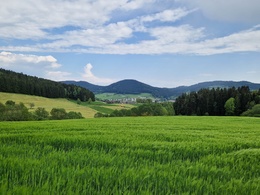
O5 Mayrhöfenweg


- Suitable for families
- Suitable for pushchairs
- Flatly
Interactive elevation profile
Create PDF
Tour-Details
Paths covering:
The route is signposted O5.
From the municipal office, cross the Nordkammlandesstraße and continue in the direction of Freistadt. At the crest, follow the goods road to the right to the Rannerhof.
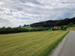
After passing a detached farm, turn left after a few metres onto a dirt track, which you follow. In the forest, turn left onto the farm track, which ends back on the Nordkammlandesstraße. Watch out for traffic when crossing! Follow the path through Mayrhöfen to the next farm, then turn left again onto the goods road that takes you to Wartberg.
The path is poorly signposted here! Go straight over the country road and follow the goods road. Turn left and follow the path in the direction of "Häuser Wartberg 9-14a,17". After the bridge, we find the next signpost on the left.
From here, the route leads back to St. Oswald, past the church and back to the parish on the right.
Safety instructions:
The hike leads through the village of St. Oswald bei Freistadt, along the pavement of the Nordkammstrasse. This must be crossed again in the course of the hike. Some sections lead along goods roads that are not very busy, but traffic is always to be expected.
- Suitable for pushchairs
- Suitable for seniors
- Suitable for single travelers
- Suitable for friends
- Suitable for couples
- Suitable for children
- Spring
- Summer
- Autumn
Please get in touch for more information.
Markt 80
4271 St. Oswald bei Freistadt
Phone +43 7945 7255
E-Mail gemeinde@stoswald.at
Web www.stoswald.at
Web www.muehlviertel-urlaub.at/wandern
http://www.muehlviertel-urlaub.at/wandern
Interactive elevation profile
Create PDF
Tour-Details
Paths covering: