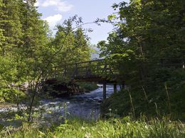
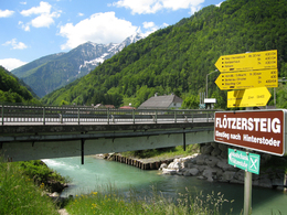
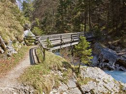
© Photo: Oberösterreich Tourismus GmbH./Robert Maybach: Enjoy the view in Upper Austria
Enjoy the view in Upper Austria
Search
Search
Close

Flötzersteig Course XL - Salomon Running & Walking Arena – brown course H4

  • Flatly

 Interactive elevation profile

Download GPS data
Create PDF

Tour-Details

Starting place: 4573 Hinterstoder
Destination: 4573 Hinterstoder

duration: 4h 42m
length: 14,3 km
Altitude difference (uphill): 564m
Altitude difference (downhill): 564m

Lowest point: 514m
Highest point: 649m
difficulty: difficult
condition: difficult
panoramic view: Great panorama

Paths covering:
Hiking trail

powered by TOURDATA

Partial lock: Flötzersteig - Teilsperre
Time period: 23.04.2024 - 27.04.2024

Description: The Flötzersteig is closed from 24.04. to 26.04.2024 from the MUCK bridge (Prielkreuz) to Karlbauerweg due to logging.

Salomon Running & Walking Arena Hinterstoder – Flötzersteig Course XL – brown course 4
Long, challenging course alongside the Steyr in beautiful countryside, over the Stampfl bridge and the Eselsbach together with the yellow course on the Steyrsberg and back to the starting point.
Starting point: theme park Hinterstoder
Destination: theme park Hinterstoder

further information:
  • Flatly
  • Board possible

Accessibility / arrival

by car:
From Vienna: West motorway direction Salzburg - A1 junction Voralpenkreuz - A9, exit Hinterstoder / St. Pankraz - Hinterstoder
From Munich: A8 Salzburg - West motorway A1 direction Linz - turn Voralpenkreuz - A9, exit Hinterstoder / St. Pankraz - Hinterstoder
From Berlin: A9 Bayreuth - Nuremberg - A3 Regensburg - Passau - A8 to junction Voralpenkreuz - A9, exit Inzersdorf - Kirchdorf / Krems - Hinterstoder

by train:
Vienna - Linz - Hinterstoder;
Munich - Salzburg - Linz - Hinterstoder;
Hamburg - Passau - Linz - Hinterstoder;
Frankfurt - Passau - Linz - Hinterstoder;
Berlin - Nürnberg - Passau - Linz - Hinterstoder;

Travelling by public transport
Route planner for independent travellers
Most economical season
  • Summer

Please get in touch for more information.


Flötzersteig Course XL - Salomon Running & Walking Arena – brown course H4
Pyhrn-Priel Tourismus GmbH
Hinterstoder 38
4573 Hinterstoder

Phone +43 7564 5263
Fax machine +43 7564 5263 - 30
E-Mail hinterstoder@pyhrn-priel.net
Web www.urlaubsregion-pyhrn-priel.at
http://www.urlaubsregion-pyhrn-priel.at

We speak the following languages

German

 Interactive elevation profile

Download GPS data
Create PDF

Tour-Details

Starting place: 4573 Hinterstoder
Destination: 4573 Hinterstoder

duration: 4h 42m
length: 14,3 km
Altitude difference (uphill): 564m
Altitude difference (downhill): 564m

Lowest point: 514m
Highest point: 649m
difficulty: difficult
condition: difficult
panoramic view: Great panorama

Paths covering:
Hiking trail

powered by TOURDATA