

Weißenbachtal - Hutterer Höss


Interactive elevation profile
Create PDF
Tour-Details
Starting place: 4573 Hinterstoder
Destination: 4573 Hinterstoder
duration: 4h 11m
length: 7,8 km
Altitude difference (uphill): 911m
Altitude difference (downhill): 177m
Lowest point: 646m
Highest point: 1.525m
difficulty: medium
condition: medium
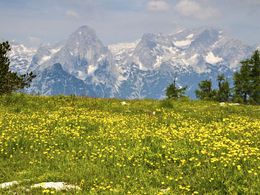
panoramic view: Great panorama
Paths covering:
Asphalt
powered by TOURDATA
A very romantic side valley of the Stodertal valley is the Weißenbachtal valley. Starting point is the Weißenbach chapel (Bus stop), situated 4 km from the village of Hinterstoder into the valley. Take a tar road over the stream leading along Weißenbach stream to the highest farmhouse of the municipality, the Buchebnerreith farm.
Continue now along trail nr. 15 ascending in steep serpentines a bit further on until you reach the edge of the ridge below the Hutterer alpine pastures along trail nr. 37. Now you can either continue to the mountain inn Berggasthaus Hutterer Höss or descend passing the reservoirs to the Hutterer Böden.
To get into the valley you can choose either the easier option by taking the cable car or walk along trail nr. 217.
Trail-Nr: 14, 15
")
Accessibility / arrival
by car:
From Vorderstoder follow signs Hinterstoder - At the crossroads turn left to Hinterstoder - to Weissbach Chapel
A9 motorway - exit St. Pankraz - then turn left - at GH Steyrbrücke left to Hinterstoder
by bus:
Or take the bus to Hinterstoder to Weissbach Chapel (bus stop)
Most economical season
- Summer
Please get in touch for more information.
Hinterstoder 38
4573 Hinterstoder
Phone +43 7564 5263 - 99
Fax machine +43 7564 5263 - 30
E-Mail hinterstoder@pyhrn-priel.net
Web www.urlaubsregion-pyhrn-priel.at
http://www.urlaubsregion-pyhrn-priel.at
Interactive elevation profile
Create PDF
Tour-Details
Starting place: 4573 Hinterstoder
Destination: 4573 Hinterstoder
duration: 4h 11m
length: 7,8 km
Altitude difference (uphill): 911m
Altitude difference (downhill): 177m
Lowest point: 646m
Highest point: 1.525m
difficulty: medium
condition: medium
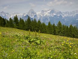
panoramic view: Great panorama
Paths covering:
Asphalt
powered by TOURDATA