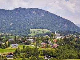
© Photo: Oberösterreich Tourismus GmbH./Robert Maybach: Enjoy the view in Upper Austria


Vorderstoder - Hinterstoder


Interactive elevation profile
Create PDF
Tour-Details
Path number: 201
Starting place: 4574 Vorderstoder
Destination: 4574 Hinterstoder
duration: 5h 0m
length: 15,4 km
Altitude difference (uphill): 191m
Altitude difference (downhill): 388m
Lowest point: 582m
Highest point: 805m
difficulty: easy
condition: easy
panoramic view: No view
Paths covering:
Asphalt, Hiking trail
powered by TOURDATA
Hiking in the Stodertal – From the town center in Vorderstoder, you will hike into the center of Hinterstoder!
After the mid station of the Hackl lift, hiking path no. 201 leads right past the Hutgrabner farm and then slightly downhill for quite a ways following the road. Before the next farmhouse, the path turns left and goes over a bridge through meadows and a forest, past a small house, and to the Wartegg farm.
Here, you will stay on hiking path No. 201 and go past Landhotel Gressenbauer and Relax- & Wanderhotel Poppengut. At first, you will hike along the path and then along the road into the town center of Hinterstoder.
Path No.: 201
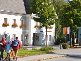
Starting point: tourist office in Vorderstoder
Destination: tourist office in Vorderstoder
further information:
- Board possible
Details - hiking
- cleared winter hiking path
")

")
")
Accessibility / arrival
Vorderstoder is very well served by public transport: oebb.at
By car:
Motorway A1 to A9, exit Voralpenkreuz Hinterstoder, country road to Hinterstoder - 200 meters after the sign turn left to Vorderstoder Hinterstoder (approx 5 km).
Pyhrnbahn stop Windischgarsten (10 km) or Hinterstoder (15 km) -> from the place
Linz / Hörsching 80 km away from the place
Most economical season
- Spring
- Summer
- Autumn
Please get in touch for more information.

Hinterstoder 38
4574 Vorderstoder
Phone +43 7564 8255
Fax machine +43 7564 8255 - 20
E-Mail vorderstoder@pyhrn-priel.net
Web www.urlaubsregion-pyhrn-priel.at/
https://www.urlaubsregion-pyhrn-priel.at/
Interactive elevation profile
Create PDF
Tour-Details
Path number: 201
Starting place: 4574 Vorderstoder
Destination: 4574 Hinterstoder
duration: 5h 0m
length: 15,4 km
Altitude difference (uphill): 191m
Altitude difference (downhill): 388m
Lowest point: 582m
Highest point: 805m
difficulty: easy
condition: easy
panoramic view: No view
Paths covering:
Asphalt, Hiking trail
powered by TOURDATA