

Angerkogel ski tour (tour area Hintersteineralm)


Interactive elevation profile
Create PDF
Tour-Details
Starting place: 4582 Spital am Pyhrn
Destination: 4582 Spital am Pyhrn
duration: 7h 33m
length: 13,8 km
Altitude difference (uphill): 1.294m
Altitude difference (downhill): 1.290m
Lowest point: 937m
Highest point: 2.085m
difficulty: medium
condition: medium
panoramic view: Great panorama
Paths covering:
snow
powered by TOURDATA
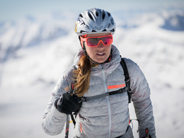
Ski tour to Anger mountain (2,114 m) in the touring area Hintersteineralm! The ski tour to the Anger Kogel is a beautiful and safe mid-winter tour , often until late in the spring of powder snow. Usually the tour is made possible by the beneficiary , high starting position even in December. It is also suitable for beginners , but in bad weather and fog in the summit area there is a difficult orientation.
ascent:
From the Pyhrnpass follow the road back to the huts , the Hintersteinersee pastures. Then it goes further to the left over a bridge to cross the stream to the head of the valley . Now by the Gschwandgraben further , at the beginning narrow, partially fallen trees , upwards.
Finally, it is wider again , you've crossed a forest road then turn right along the road upwards. Turn left and follow the most existing riser traces after about 1,500 meters. This first run through a dense forest , later always west to Aiplhütte ( hunting lodge ) .
Now you rise above the plateau high straight ahead . Be especially in bad weather and fog careful because of the difficult orientation.
Over a sparse forest, it is now somewhat uphill and downhill into a beautiful larch and pine forests . The rocks of the Torkoppe you can lie to the left and climb up to the saddle . Here you will find a beautiful view of the summit and the further ascent. First, it goes downhill a bit , then over the southern slope upward. Keep yourself in the end something right and you reach the summit of Anger Kogel in 2,114 meters .
Departure:
The descent is initially as the ascent. When you reach the forest road you do not go now into the Gschwandgraben , but follow the road to the left until Hintersteineralm . You can also alternatively choose the type using the Lärchkogelgraben .
Departure variant :
Just above the Aiplhütte , turn right and go through the larch Kogel digging up the forest road , then follow further the advancement track.
Starting point: There are a maximum of 50 parking spaces available at the car park at the former road maintenance depot on the Pyhrnpass (parking fee)! Other parking options: Wurzeralm cable car car park (tourist fee is to be paid at the cash desk), car park at the Pyhrnpass pass summit or at the Lexgraben (state border with Styria).
Destination: There are a maximum of 50 parking spaces available at the car park at the former road maintenance depot on the Pyhrnpass (parking fee)! Other parking options: Wurzeralm cable car car park (tourist fee is to be paid at the cash desk), car park at the Pyhrnpass pass summit or at the Lexgraben (state border with Styria).
Details - Ski
- Descent: difficulty: medium, 1136 Metres of altitude
Accessibility / arrival
Coming from Spital am Pyhrn, drive onto the Pyhrnpass (B138).
The car park at the former road maintenance depot on the Pyhrn Pass offers a maximum of 50 parking spaces (for a fee)!
Other parking options: Wurzeralm cable car car park (tourist fee is to be paid at the cash desk), car park at the Pyhrnpass pass summit or at the Lexgraben (state border with Styria).
- Parking space: 50
General price information
A maximum of 50 parking spaces are available at the car park at the former road maintenance depot on the Pyhrn Pass (for a fee)!
Payment methods
Other payment methods
Cash payment
- Suitable for seniors
- Suitable for single travelers
- Suitable for friends
- Suitable for couples
- Early winter
- Deep winter
Please get in touch for more information.
Stiftsplatz 1
4582 Spital am Pyhrn
Phone +43 7563 249
Fax machine +43 7563 249 - 20
E-Mail spital@pyhrn-priel.net
Web www.urlaubsregion-pyhrn-priel.at
http://www.urlaubsregion-pyhrn-priel.at
Interactive elevation profile
Create PDF
Tour-Details
Starting place: 4582 Spital am Pyhrn
Destination: 4582 Spital am Pyhrn
duration: 7h 33m
length: 13,8 km
Altitude difference (uphill): 1.294m
Altitude difference (downhill): 1.290m
Lowest point: 937m
Highest point: 2.085m
difficulty: medium
condition: medium
panoramic view: Great panorama
Paths covering:
snow
powered by TOURDATA