

St. Konrad's trail


- Suitable for families
- culturally interesting
Interactive elevation profile
Create PDF
Tour-Details
Starting place: 5310 Tiefgraben am Mondsee
Destination: 5310 Tiefgraben am Mondsee
duration: 3h 10m
length: 10,0 km
Altitude difference (uphill): 366m
Altitude difference (downhill): 304m
Lowest point: 512m
Highest point: 703m
difficulty: medium
condition: medium
panoramic view: Great panorama
Paths covering:
Asphalt, Hiking trail
powered by TOURDATA
Höhenweg in the footsteps of St. Konrad.
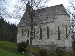
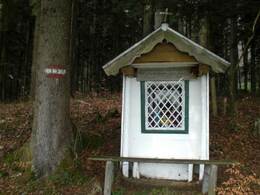
Take the bus to the village center of Oberwang.Yellow signs show you the way to the Konradkirche. If you want to visit the church ask for the key at the house next door. The Konradweg leads through the woods. After 15 minutes you'll reach the Konradkapelle and Konradspring.
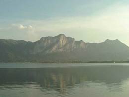
Follow the yellow signs (route no. 21 and also the pilgrims way VIA NOVA). You walk through meadows and woods - alwiys a nice view of Mondsee and the lake. Pass under the motorway and reach the famous pilgrim church Maria Hilf. Walk down the hill to the basilica of Mondsee. There the relict of St. Konrad is exhibited on the main altar.
Starting point: Basilica St. Michael Mondsee in the center of Mondsee
Destination: Konrad-church in Oberwang
further information:
")
")
")
")
Accessibility / arrival
The tour starts in the center of Mondsee, or from the other side in the center of Oberwang.
- Parking space: 20
yes
- Suitable for groups
- Suitable for teenagers
- Suitable for seniors
- Suitable for single travelers
- Suitable for friends
- Suitable for couples
- Suitable for children
- Spring
- Summer
- Autumn
- Early winter
Please get in touch for more information.
Dr. Franz Müller Straße 3
5310 Mondsee am Mondsee
Phone +43 6232 2270
Fax machine +43 6232 2270 - 22
E-Mail info@mondsee.at
Web www.mondsee.at
http://www.mondsee.at
Interactive elevation profile
Create PDF
Tour-Details
Starting place: 5310 Tiefgraben am Mondsee
Destination: 5310 Tiefgraben am Mondsee
duration: 3h 10m
length: 10,0 km
Altitude difference (uphill): 366m
Altitude difference (downhill): 304m
Lowest point: 512m
Highest point: 703m
difficulty: medium
condition: medium
panoramic view: Great panorama
Paths covering:
Asphalt, Hiking trail
powered by TOURDATA