

Traun Bike Trail R4


- Suitable for families
Interactive elevation profile
Create PDF
Tour-Details
Path number: R4
Starting place: 4810 Gmunden
Destination: 4481 Asten
duration: 5h 21m
length: 82,8 km
Altitude difference (uphill): 180m
Altitude difference (downhill): 361m
Lowest point: 245m
Highest point: 465m
difficulty: medium
condition: medium
panoramic view: Some Views
Paths covering:
Asphalt, Gravel
powered by TOURDATA
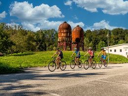
The Traun bike trail is one of the most important north-south routes for cyclists in Upper Austria.
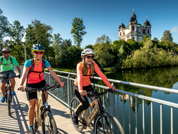
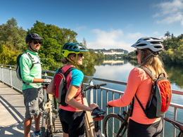
You cycle from the beautiful town hall square in Gmunden am Traunsee along the Traun river to the “Marienbrücke” bridge (a short bike pushing distance of approx. 100 metres), then you continue via Laakirchen and Ohlsdorf to the Traunfall river falls. The route continues in the direction of Stadl-Paura and Lambach with its Benedictine monastery. Continue along the river to Wels. You finally reach your destination in Linz, where the Traun river flows into the Danube river.
Signage: R4 (Part of the Upper Austrian cycling network)
Opening times of the power plant bridges at Ottensheim – Wilhering and Abwinden – Asten: open to cyclists all year round and 24 hours a day
In the area of Laakirchen (Steyrermühl to be exact), the route had to be adjusted at short notice due to the existing bridge closure and changed for about 300 meters along the main road. We ask for your understanding!
Starting point: Gmunden - Traun bridge
Destination: Junction with Danube bike trail at Abwinden/Asten.
further information:
- Board possible
")
Accessibility / arrival
By car:
A1 highway Vienna - Salzburg - exit Steyrermühl B 144 towards Gmunden or Regau B 145 towards Gmunden for 7 km. Access from motorway also possible from Lindach and Vorchdorf exits.
From Germany via Passau on A 8 to Wels intersection, continue on the A8 south until Voralpenkreuz intersection, then take A1 towards Salzburg to the exits noted above.
By train:
Main Western line (No. 100.) Salzburg - Vienna changing at Attnang / Puchheim, take the Salzkammergut line (No. 170.) to Gmunden station.
From Germany via Passau to Wels, change in the direction Attnang / Puchheim taking the Salzkammergut line (No. 170) to Gmunden station.
From Graz Selzthal and Stainich Irdning to Gmunden.
- Suitable for single travelers
- Spring
- Summer
- Autumn
Please get in touch for more information.
Freistädter Straße 119
4041 Linz
Phone +43 732 221022
Fax machine +43 732 7277 - 701
E-Mail info@oberoesterreich.at
Web www.oberoesterreich.at/
https://www.oberoesterreich.at/

")
Interactive elevation profile
Create PDF
Tour-Details
Path number: R4
Starting place: 4810 Gmunden
Destination: 4481 Asten
duration: 5h 21m
length: 82,8 km
Altitude difference (uphill): 180m
Altitude difference (downhill): 361m
Lowest point: 245m
Highest point: 465m
difficulty: medium
condition: medium
panoramic view: Some Views
Paths covering:
Asphalt, Gravel
powered by TOURDATA