© Photo: Oberösterreich Tourismus GmbH./Robert Maybach: Enjoy the view in Upper Austria


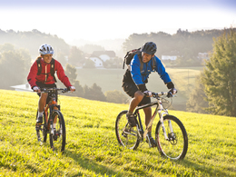
Mountainbikestrecke "Donau-Ameisberg-Runde"


- All weather
- Suitable for families
- culinary interesting
- culturally interesting
- Flatly
- Possible accommodation
Interactive elevation profile
Create PDF
Tour-Details
Starting place: 4132 Lembach im Mühlkreis
Destination: 4132 Lembach im Mühlkreis
duration: 6h 51m
length: 77,5 km
Altitude difference (uphill): 2.005m
Altitude difference (downhill): 2.013m
Lowest point: 280m
Highest point: 818m
difficulty: medium
condition: medium
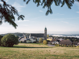
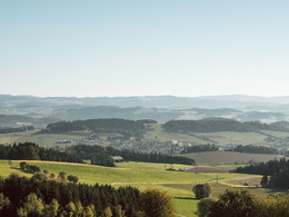
panoramic view: Great panorama
Paths covering:
unfixed
powered by TOURDATA
DONAU-AMEISBERG-ROUND
This tour takes you to the most scenic places in the Mühlviertel. From Lembach you cycle via Putzleinsdorf to the castle ruins of Haichenbach. From the vantage point after the village of Dorf you can enjoy the unique view of the Schlögener Donauschling. Descend to the Danube and along the Danube cycle path to Niederranna. The route winds its way up 500 metres via Hofkirchen to Pfarrkirchenfurther information:
- culinary interesting
- Flatly
- Possible accommodation
- Board possible
details mountainbike
- Riding technique: medium
")
")
")
")
")
")
")
")
")
")
")
")
")
")
")
")
")
")
")
")
Parking
- Parking space: 50
- All weather
- Suitable for groups
- Suitable for teenagers
- Suitable for single travelers
- Suitable for families
- Suitable for friends
- Suitable for couples
- Suitable for children
- Spring
- Summer
- Autumn
Please get in touch for more information.
Marktplatz 4
4152 Sarleinsbach
Phone +43 7283 825522
E-Mail roswitha.maerzinger@sarleinsbach.at
Web www.granitland.at/
Web www.pfarrkirchen.at/
https://www.granitland.at/
http://www.pfarrkirchen.at/
http://www.pfarrkirchen.at/
")
Interactive elevation profile
Create PDF
Tour-Details
Starting place: 4132 Lembach im Mühlkreis
Destination: 4132 Lembach im Mühlkreis
duration: 6h 51m
length: 77,5 km
Altitude difference (uphill): 2.005m
Altitude difference (downhill): 2.013m
Lowest point: 280m
Highest point: 818m
difficulty: medium
condition: medium
panoramic view: Great panorama
Paths covering:
unfixed
powered by TOURDATA