

Stodertal Course - Salomon Running & Walking Arena – purple course H2


- Flatly
Interactive elevation profile
Create PDF
Tour-Details
Starting place: 4573 Hinterstoder
Destination: 4573 Hinterstoder
duration: 1h 21m
length: 4,9 km
Altitude difference (uphill): 84m
Altitude difference (downhill): 80m
Lowest point: 582m
Highest point: 645m
difficulty: easy
condition: medium
panoramic view: Some Views
Paths covering:
Asphalt, Gravel, Hiking trail
powered by TOURDATA
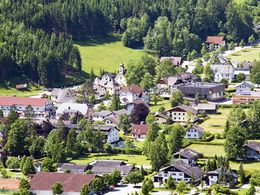
Salomon Running & Walking Arena Hinterstoder – Stodertal Course - violet course 2
The green, flat Stodertal Course is ideal if you just want to relax and enjoy, taking you mostly on a compacted natural surface along the banks of the Steyr. Connects with the Polsterlucken Course at km 2.8. After a small loop across the Steyr river, back to the original starting point.
The green, flat Stodertal Course is ideal if you just want to relax and enjoy, taking you mostly on a compacted natural surface along the banks of the Steyr. Connects with the Polsterlucken Course at km 2.8. After a small loop across the Steyr river, back to the original starting point.
Starting point: theme park Hinterstoder
Destination: theme park Hinterstoder
further information:
- Flatly
- Board possible
Accessibility / arrival
From Vienna: West motorway direction Salzburg - A1 junction Voralpenkreuz - A9, exit Hinterstoder / St. Pancrazio - Hinterstoder
From Munich: A8 Salzburg - West motorway A1 towards Linz - turn Voralpenkreuz - A9, exit Hinterstoder / St. Pancrazio - Hinterstoder
From Berlin: A9 Bayreuth - Nuremberg - A3 Regensburg - Passau - A8 to node Voralpenkreuz - A9, exit Inzersdorf - Kirchdorf / Krems - Hinterstoder
Vienna - Linz - Hinterstoder;
Munich - Salzburg - Linz - Hinterstoder;
Hamburg - Passau - Linz - Hinterstoder;
Frankfurt - Passau - Linz - Hinterstoder;
Berlin - Nürnberg - Passau - Linz - Hinterstoder;
Airports: Linz / Hörsching, Vienna, Salzburg
Most economical season
- Spring
- Summer
- Autumn
- Early winter
- Deep winter
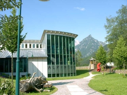
Please get in touch for more information.
Hinterstoder 38
4573 Hinterstoder
Phone +43 7564 5263 - 99
Fax machine +43 7564 5263 - 30
E-Mail hinterstoder@pyhrn-priel.net
Web www.urlaubsregion-pyhrn-priel.at
http://www.urlaubsregion-pyhrn-priel.at
")
Interactive elevation profile
Create PDF
Tour-Details
Starting place: 4573 Hinterstoder
Destination: 4573 Hinterstoder
duration: 1h 21m
length: 4,9 km
Altitude difference (uphill): 84m
Altitude difference (downhill): 80m
Lowest point: 582m
Highest point: 645m
difficulty: easy
condition: medium
panoramic view: Some Views
Paths covering:
Asphalt, Gravel, Hiking trail
powered by TOURDATA