

Polsterlucken Course - Salomon Running & Walking Arena – green course H1


- Flatly
Interactive elevation profile
Create PDF
Tour-Details
Starting place: 4573 Hinterstoder
Destination: 4573 Hinterstoder
duration: 1h 44m
length: 5,0 km
Altitude difference (uphill): 242m
Altitude difference (downhill): 226m
Lowest point: 608m
Highest point: 762m
difficulty: medium
condition: medium
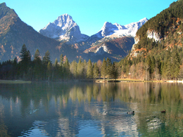
panoramic view: Great panorama
Paths covering:
Asphalt, Gravel
powered by TOURDATA
Salomon Running & Walking Arena Hinterstoder – Polsterlucken Course – green course 1
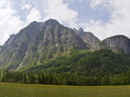
Slightly hilly course through the magical Stoder countryside, takes you on a compacted natural surface past the Schiederweiher pond. Has its own info board at the start of the tour, also connects to the Stodertal Course.
Slightly hilly course through the magical Stoder countryside, takes you on a compacted natural surface past the Schiederweiher pond. Has its own info board at the start of the tour, also connects to the Stodertal Course.
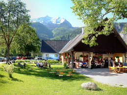
Starting point: parking area Johannishof
Destination: parking area Johannishof
further information:
- Flatly
- Board possible
Accessibility / arrival
by car:
From Vienna: West motorway direction Salzburg - A1 junction Voralpenkreuz - A9, exit Hinterstoder / St. Pancrazio - Hinterstoder
From Munich: A8 Salzburg - West motorway A1 direction Linz - turn Voralpenkreuz - A9, exit Hinterstoder / St. Pancrazio - Hinterstoder
From Berlin: A9 Bayreuth - Nuremberg - A3 Regensburg - Passau - A8 to junction Voralpenkreuz - A9, exit Inzersdorf - Kirchdorf / Krems - Hinterstoder
by train:
Vienna - Linz - Hinterstoder;
Munich - Salzburg - Linz - Hinterstoder;
Hamburg - Passau - Linz - Hinterstoder;
Frankfurt - Passau - Linz - Hinterstoder;
Berlin - Nürnberg - Passau - Linz - Hinterstoder;
Most economical season
- Summer
Please get in touch for more information.
Hinterstoder 38
4573 Hinterstoder
Phone +43 7564 5263
Fax machine +43 7564 5263 - 55
E-Mail hinterstoder@pyhrn-priel.net
Web www.urlaubsregion-pyhrn-priel.at
http://www.urlaubsregion-pyhrn-priel.at
Interactive elevation profile
Create PDF
Tour-Details
Starting place: 4573 Hinterstoder
Destination: 4573 Hinterstoder
duration: 1h 44m
length: 5,0 km
Altitude difference (uphill): 242m
Altitude difference (downhill): 226m
Lowest point: 608m
Highest point: 762m
difficulty: medium
condition: medium
panoramic view: Great panorama
Paths covering:
Asphalt, Gravel
powered by TOURDATA