

Attersee-Mondsee variant


- Flatly
Interactive elevation profile
Create PDF
Tour-Details
Starting place: 4863 Seewalchen am Attersee
Destination: 4863 Seewalchen am Attersee
duration: 7h 32m
length: 104,1 km
Altitude difference (uphill): 1.035m
Altitude difference (downhill): 1.037m
Lowest point: 466m
Highest point: 633m
difficulty: medium
condition: medium
panoramic view: Great panorama
Paths covering:
Asphalt
powered by TOURDATA
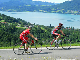
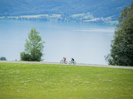
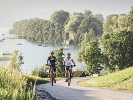
The tour starts in Seewalchen and leads along the western shore of Lake Attersee and south over Nussdorf to Unterach.
From Unterach drive west on the northern shore of Lake Mondsee and along the Mondsee. On the southern shore of the Mondsee tour of Schwarzindien, Plomberg leads to Schafling. From there you must take the road south to Mondsee St. Gilgen. On the southwestern shore you cycle alongside lake Arber, turn left in Langgassen. In Reith, you can take the ferry to St. Wolfgang. Until Schafling cycle back the same way again. Just before Schafling, you have to turn right and cycle eastwards, back to lake Attersee. On its south bank we continue to Weissenbach am Attersee. Via Steinbach, Seefeld and Weyregg you cycle back to the starting point in Seewalchen on the eastern shore.
From Unterach drive west on the northern shore of Lake Mondsee and along the Mondsee. On the southern shore of the Mondsee tour of Schwarzindien, Plomberg leads to Schafling. From there you must take the road south to Mondsee St. Gilgen. On the southwestern shore you cycle alongside lake Arber, turn left in Langgassen. In Reith, you can take the ferry to St. Wolfgang. Until Schafling cycle back the same way again. Just before Schafling, you have to turn right and cycle eastwards, back to lake Attersee. On its south bank we continue to Weissenbach am Attersee. Via Steinbach, Seefeld and Weyregg you cycle back to the starting point in Seewalchen on the eastern shore.
Most economical season
- Spring
- Summer
- Autumn
- Early winter
Please get in touch for more information.

4863 Seewalchen am Attersee
Phone +43 6232 2270
E-Mail info@mondsee.at
Web www.mondsee.at
Web attersee-attergau.salzkammergut.at
http://www.mondsee.at
https://attersee-attergau.salzkammergut.at
https://attersee-attergau.salzkammergut.at
You can also visit us on
Visit us on Facebook Visit our videochannel on YouTube WikipediaInteractive elevation profile
Create PDF
Tour-Details
Starting place: 4863 Seewalchen am Attersee
Destination: 4863 Seewalchen am Attersee
duration: 7h 32m
length: 104,1 km
Altitude difference (uphill): 1.035m
Altitude difference (downhill): 1.037m
Lowest point: 466m
Highest point: 633m
difficulty: medium
condition: medium
panoramic view: Great panorama
Paths covering:
Asphalt
powered by TOURDATA