

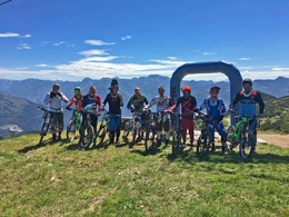
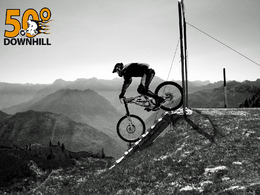
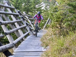
Downhill trail Feuerkogel


Interactive elevation profile
Create PDF
Tour-Details
Starting place: 4802 Ebensee
Destination: 4802 Ebensee
duration: 0h 36m
length: 6,1 km
Altitude difference (downhill): 1.114m
Lowest point: 475m
Highest point: 1.589m
difficulty: difficult
condition: difficult
panoramic view: Great panorama
Paths covering:
Path / trail, Gravel, Hiking trail
powered by TOURDATA
One of Austria’s most beautiful but also most challenging downhill courses! The 5.6 kilometer long course starts just above the top station of Feuerkogel gondola at 1600 meters above sea level. The trail is marked with signs and paint and leads across pastures (beware of cows!) and along the ski run to a wooden ramp across a fence where the fun starts! A series of long, drawn-out curves is followed by the course’s steepest and fastest section: let go of your brakes as much as possible and don’t forget to look ahead! Keep in mind that an official hiking trails is to your right! Next comes a bumpy meadow trail followed by a gnarly single trail in through a forest. Out of the forest the toughest part is waiting for you: the super steep avalanche chute! Slow down and smile! Fantastic views of Lake Traunsee! Things will be getting easier from here on: some fast curves take you to the course’s last section, a selective and narrow passage through a forest, before it ends at the parking lot of Feuerkogel gondola. Biking washing facilities are available at the parking lot. Protective gear and helmets are mandatory! This course is not suitable for beginners! In wet conditions you should slap on your mud tires for good grip. For detailed information please contact the Ebensee Tourist Office.
Starting point: above the mountain station of the cable car "Feuerkogel"
Destination: parking lot of the cable car "Feuerkogel"
further information:
- Board possible
details mountainbike
- Riding technique: difficult
- Ascent aid available
Open from 17. May till 28. October 2012 daily from 8.30 to 17.00 o'clock. During the high season and on weekends there can be a longer waiting time between 11.00 and 14.00 o'clock.


Accessibility / arrival
from the highway: departure Regau-B 145 in the direction of Bad Ischl-turn right to Ebensee-in front of the bridge turn right to the parking lot of the cable car "Feuerkogel"
Payment methods
Debit and credit cards
ATM card
Mastercard
Other payment methods
Cash payment
Most economical season
- Spring
- Summer
- Autumn
Please get in touch for more information.
4802 Ebensee
Phone +43 50 140
E-Mail ebensee@traunsee-almtal.at
Web www.bikepark-info.com/bikeparks/at/…
Web www.facebook.com/groups/12997940035…
https://www.bikepark-info.com/bikeparks/at/feuerkogel-downhill
https://www.facebook.com/groups/129979400351777
https://www.facebook.com/groups/129979400351777
Interactive elevation profile
Create PDF
Tour-Details
Starting place: 4802 Ebensee
Destination: 4802 Ebensee
duration: 0h 36m
length: 6,1 km
Altitude difference (downhill): 1.114m
Lowest point: 475m
Highest point: 1.589m
difficulty: difficult
condition: difficult
panoramic view: Great panorama
Paths covering:
Path / trail, Gravel, Hiking trail
powered by TOURDATA