At the Traunleiten


- pets allowed
- Suitable for pushchairs
- culinary interesting
- culturally interesting
- Flatly
- Possible accommodation
Interactive elevation profile
Create PDF
Tour-Details
Path number: 10
Starting place: 4654 Bad Wimsbach-Neydharting
Destination: 4654 Bad Wimsbach-Neydharting
duration: 3h 15m
length: 13,0 km
Altitude difference (uphill): 70m
Altitude difference (downhill): 64m
Lowest point: 374m
Highest point: 428m
difficulty: easy
condition: medium
panoramic view: Some Views
Paths covering:
Asphalt, Hiking trail
powered by TOURDATA
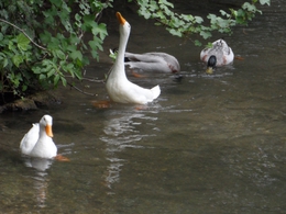
Long circular route on the road and in the forest with beautiful impressions along the river Traun.
Start at the Gasthaus Dickinger via Stadl Paura.
This path can also be used well by bike.
Start at the Gasthaus Dickinger via Stadl Paura.
This path can also be used well by bike.
Parking
- Parking space: 40
- Bus parking space: 1
- Suitable for groups
- Suitable for pushchairs
- Pets allowed
- Summer
Please get in touch for more information.
M
4654 Bad Wimsbach-Neydharting
Phone +43 7245 25055 - 0
E-Mail almtal@traunsee-almtal.at
Web www.bad-wimsbach.at
Web www.traunsee-almtal.at
http://www.bad-wimsbach.at
https://www.traunsee-almtal.at
https://www.traunsee-almtal.at
You can also visit us on
Visit us on FacebookInteractive elevation profile
Create PDF
Tour-Details
Path number: 10
Starting place: 4654 Bad Wimsbach-Neydharting
Destination: 4654 Bad Wimsbach-Neydharting
duration: 3h 15m
length: 13,0 km
Altitude difference (uphill): 70m
Altitude difference (downhill): 64m
Lowest point: 374m
Highest point: 428m
difficulty: easy
condition: medium
panoramic view: Some Views
Paths covering:
Asphalt, Hiking trail
powered by TOURDATA

