bridleway


- pets allowed
- Suitable for families
- Flatly
Interactive elevation profile
Create PDF
Tour-Details
Starting place: 4251 Sandl
Destination: 4251 Sandl
duration: 7h 3m
length: 25,0 km
Altitude difference (uphill): 481m
Altitude difference (downhill): 482m
Lowest point: 861m
Highest point: 1.006m
difficulty: medium
condition: medium
panoramic view: Dreamtour
Paths covering:
Asphalt
powered by TOURDATA
Trail riding "non plus ultra" - at 1,000 m in only 15% asphalt content. 25 km forest roads through beautiful high forests at an altitude of around 1000 m. The route leads across the plateau with only slight differences in height to the "1.112er Viehberg".
The short paved access road sections you will notice almost not.
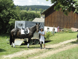
Beautiful new stall barn with family Stauber in place overnight in the adjacent host or neighbor in the first class private quarters.
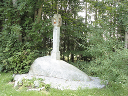
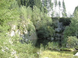
Attractions on the bridle path: one of the most powerful observatories in Europe Sandl, stone walls under protection of wind turbines Spörbichl, Zehentkasten in Spörbichl, Steinbruchsee at Mitterbach shrine from 1706.
Member companies on bridle path: RH Stauber in Sandl (start, 930m), RR Lukawirt in Sandl (km 4, 940 m), RR Forellenwirt Kastler in Mitterbach (Km 9, 880 m), RR Wittmann Pürstling (km 19; 880 m)
further information:
- Flatly
- Board possible
Details riding
- Area: medium
- Good riding experience: easy
- Feeding possible for horses
- Housing possibility for horses
- Accommodations for riders
- horse trough
- paddock
Spring, Summer, Autumn
General price information
no costs
- Free entry
- voluntary contribution
- Suitable for groups
- Suitable for schools
- Pets allowed
- Summer
Please get in touch for more information.
4251 Sandl
Phone +43 7949 6313
E-Mail office@reit-erlebnis-akademie.at
Web www.reit-erlebnis-akademie.at
Web www.gps-tour.info/de/touren/detail.…
http://www.reit-erlebnis-akademie.at
http://www.gps-tour.info/de/touren/detail.427.html
http://www.gps-tour.info/de/touren/detail.427.html
Interactive elevation profile
Create PDF
Tour-Details
Starting place: 4251 Sandl
Destination: 4251 Sandl
duration: 7h 3m
length: 25,0 km
Altitude difference (uphill): 481m
Altitude difference (downhill): 482m
Lowest point: 861m
Highest point: 1.006m
difficulty: medium
condition: medium
panoramic view: Dreamtour
Paths covering:
Asphalt
powered by TOURDATA


