

Höss Alpine Circular Trail (Circular Hiking World Hinterstoder)


- Flatly
Interactive elevation profile
Create PDF
Tour-Details
Starting place: 4573 Hinterstoder
Destination: 4573 Hinterstoder
duration: 1h 10m
length: 3,4 km
Altitude difference (uphill): 161m
Altitude difference (downhill): 163m
Lowest point: 1.805m
Highest point: 1.966m
difficulty: medium
condition: medium
panoramic view: Dreamtour
Paths covering:
Gravel, Hiking trail
powered by TOURDATA
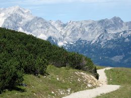
From the starting point at the top of the 6-person chairlift – the Höss Express – you follow the trail of the Höss Circular Trail to the snow oven (Schneeofen), soon after which the Höss Alpine Circular Trail forks off southwards to the Schafkögel mountain. The path meanders downhill again along the western edge of the terrain with steep drops down into the Weißenbach Valley to reconnect after a 200m drop in height with the Höss Circular Path just above the viewing platform „Dachsteinblick“.
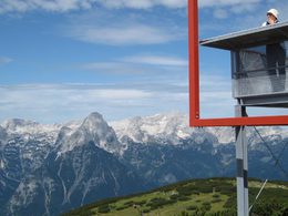
Starting point: Höss Mountain Station Express in Hinterstoder on the Hutterer Höss
Destination: Höss Mountain Station Express in Hinterstoder on the Hutterer Höss
further information:
- Flatly
- Board possible
Details - hiking
- themed path
")
Accessibility / arrival
From the center of Hinterstoder, take the 6 person cabin railway and the Höss-Express 6-seater chair lift to the starting point of the Höss-round. Parking at the large car park at the beginning of Hinterstoder.
- Suitable for single travelers
- Suitable for friends
- Suitable for couples
- Suitable for children
- Spring
- Summer
- Autumn
Please get in touch for more information.

Hinterstoder 38
4573 Hinterstoder
Phone +43 7564 5263
Fax machine +43 7564 5263 - 30
E-Mail hinterstoder@pyhrn-priel.net
Web www.urlaubsregion-pyhrn-priel.at
https://www.urlaubsregion-pyhrn-priel.at
Interactive elevation profile
Create PDF
Tour-Details
Starting place: 4573 Hinterstoder
Destination: 4573 Hinterstoder
duration: 1h 10m
length: 3,4 km
Altitude difference (uphill): 161m
Altitude difference (downhill): 163m
Lowest point: 1.805m
Highest point: 1.966m
difficulty: medium
condition: medium
panoramic view: Dreamtour
Paths covering:
Gravel, Hiking trail
powered by TOURDATA