

Cider Farmers Circular Trail (Circular Hiking World Hinterstoder)


- Flatly
Interactive elevation profile
Create PDF
Tour-Details
Starting place: 4573 Hinterstoder
Destination: 4573 Hinterstoder
duration: 4h 21m
length: 10,7 km
Altitude difference (uphill): 675m
Altitude difference (downhill): 668m
Lowest point: 530m
Highest point: 821m
difficulty: medium
condition: medium
panoramic view: Individual Views
Paths covering:
Asphalt, Gravel, Hiking trail
powered by TOURDATA
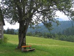
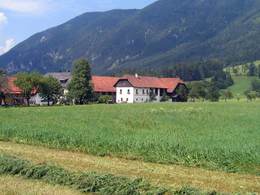
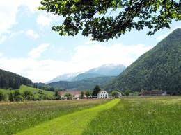
The area Tambergau is situated four kilometres before reaching the village centre of Hinterstoder. The lengthy trail starts at the „Sagmeister“ bridge and leads a short way back up the valley along the Stoder Valley main road. Pass the farmhouses Peterhof and Grausgrab to follow the trail along the wooded slope of the Tamberg mountain to the Salmer farm. Pass the Bruderhof farm and follow the path from the Immerl farm along a tar-road down to the Eselsbach stream and cross over to the other side to the foot of the Steyersberg mountain leading you up the mountain to the Friedl farm. Up there you cross over into the Loigis Valley where the route turns to lead underneath the Stensberger farm and further on to a forest leading to the Poppenberg mountain. The forest leads gently down the Steyersberg mountain through a beech forest back to your starting point.
Starting point: Sagmeisterbrücke in the district Tambergau Hinterstoder holiday farm at Peterhof.
Destination: Sagmeisterbrücke in the district Tambergau Hinterstoder holiday farm at Peterhof.
further information:
- Flatly
- Board possible
Details - hiking
- themed path

Accessibility / arrival
Starting point is the Sagmeisterbrücke, about 3 km before the center Hinterstoder.
Most economical season
- Spring
- Summer
- Autumn
Please get in touch for more information.

Hinterstoder 38
4573 Hinterstoder
Phone +43 7564 5263
Fax machine +43 7564 5263 - 30
E-Mail hinterstoder@pyhrn-priel.net
Web www.urlaubsregion-pyhrn-priel.at
https://www.urlaubsregion-pyhrn-priel.at
Interactive elevation profile
Create PDF
Tour-Details
Starting place: 4573 Hinterstoder
Destination: 4573 Hinterstoder
duration: 4h 21m
length: 10,7 km
Altitude difference (uphill): 675m
Altitude difference (downhill): 668m
Lowest point: 530m
Highest point: 821m
difficulty: medium
condition: medium
panoramic view: Individual Views
Paths covering:
Asphalt, Gravel, Hiking trail
powered by TOURDATA