

Poppenberg of Hinterstoder


Interactive elevation profile
Create PDF
Tour-Details
Path number: 26
Starting place: 4573 Hinterstoder
Destination: 4573 Hinterstoder
duration: 0h 59m
length: 1,1 km
Altitude difference (uphill): 247m
Altitude difference (downhill): 27m
Lowest point: 582m
Highest point: 802m
difficulty: medium
condition: medium
panoramic view: Great panorama
Paths covering:
Hiking trail
powered by TOURDATA
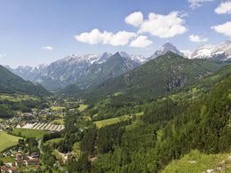
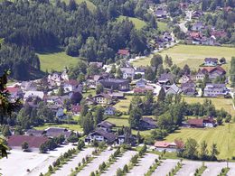
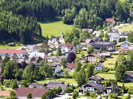
At the onset of the village of Hinterstoder you will find the forest covered and rocky ridge of the Poppenberg mountain. Next to the petrol station of Hinterstoder is the beginning of trail nr. 26, a fortified walking path leading to the foot of a steep hill. From there the path goes uphills in steep turns and serpentines through the forest. As you step out of the forest on top of the mountain, a stunning circular view of the peaks of the Tote Gebirge mountain range and the Stoder valley opens up before you (rest benches).
New: Viewing platform! Not far from the resting benches there is an antenna from where you continue along a newly errected forest road to either Mitterstoder or Tambergau or to the Strumboding - Waterfalls.
Trail-Nr: 26
New: Viewing platform! Not far from the resting benches there is an antenna from where you continue along a newly errected forest road to either Mitterstoder or Tambergau or to the Strumboding - Waterfalls.
Trail-Nr: 26
Starting point: Parking at the gas station Hinterstoder, directly in the city limits!
Destination: Poppenberg
Accessibility / arrival
From the large car park at the beginning of Hinterstoder walk about 10 minutes to the gas station / route no 26
Most economical season
- Spring
- Autumn
Please get in touch for more information.

Hinterstoder 38
4573 Hinterstoder
Phone +43 7564 5263 - 99
Fax machine +43 7564 5263 - 30
E-Mail hinterstoder@pyhrn-priel.net
Web www.urlaubsregion-pyhrn-priel.at
http://www.urlaubsregion-pyhrn-priel.at
Interactive elevation profile
Create PDF
Tour-Details
Path number: 26
Starting place: 4573 Hinterstoder
Destination: 4573 Hinterstoder
duration: 0h 59m
length: 1,1 km
Altitude difference (uphill): 247m
Altitude difference (downhill): 27m
Lowest point: 582m
Highest point: 802m
difficulty: medium
condition: medium
panoramic view: Great panorama
Paths covering:
Hiking trail
powered by TOURDATA