

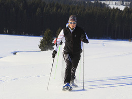
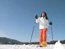
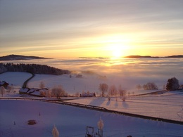
Winter hiking trail Mühlviertler Hochland


- pets allowed
- Suitable for families
- Suitable for kids (all ages)
- Flatly
Interactive elevation profile
Create PDF
Tour-Details
Starting place: 4170 St. Stefan-Afiesl
Destination: 4170 St. Stefan-Afiesl
duration: 1h 34m
length: 5,2 km
Altitude difference (uphill): 120m
Altitude difference (downhill): 90m
Lowest point: 820m
Highest point: 920m
difficulty: easy
condition: easy
panoramic view: Dreamtour
Paths covering:
snow
powered by TOURDATA
Easy hike. For all fitness levels. Easily walkable paths. No special skill required.
Starting point: Mayrwirt in St. Stefan/W.
Destination: Mayrwirt in St. Stefan/W.
further information:
- Flatly
- Board possible
Open when the snow is Right.
Parking
- Parking space: 20
- Parking area for disabled: 1
- Bus parking space: 1
- Suitable for groups
- Suitable for kids (all ages)
- Pets allowed
- Suitable for single travelers
- Suitable for friends
- Suitable for couples
- Suitable for children
- Deep winter
Somewhat suitable for wheelchairs: Assistance is sometimes necessary. The measurements do not (fully) conform to the legally stipulated ÖNORM.
Hauptplatz 19
4190 Bad Leonfelden
Phone +43 7213 6397
E-Mail office@muehlviertlerhochland.at
Web www.muehlviertlerhochland.at
https://www.muehlviertlerhochland.at
Interactive elevation profile
Create PDF
Tour-Details
Starting place: 4170 St. Stefan-Afiesl
Destination: 4170 St. Stefan-Afiesl
duration: 1h 34m
length: 5,2 km
Altitude difference (uphill): 120m
Altitude difference (downhill): 90m
Lowest point: 820m
Highest point: 920m
difficulty: easy
condition: easy
panoramic view: Dreamtour
Paths covering:
snow
powered by TOURDATA