

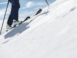
Ski tour Lagelsberg - Zeller path (tour area Vorderstoder)


- Possible accommodation
Interactive elevation profile
Create PDF
Tour-Details
Starting place: 4574 Vorderstoder
Destination: 4574 Vorderstoder
duration: 7h 14m
length: 10,7 km
Altitude difference (uphill): 1.300m
Altitude difference (downhill): 1.307m
Lowest point: 734m
Highest point: 1.986m
difficulty: difficult
condition: difficult
panoramic view: Great panorama
Paths covering:
snow
powered by TOURDATA
The Tour of Rotbuchner in Vorderstoder to Lagelsberg leads past the Zellerhütte and often offers fantastic powder snow! From the parking lot you must follow the signs ski. First, keep to the left, then over meadows straight up, cross the road and continue to the edge of the forest. Now go to the forest road towards Zellerhütte to the valley station of the ropeway. Now we ever steeper and you get to Zellerhütte to 1.575 m. From the hut we continue on a flatter and brighter larch forest up the mountain on the Schaller Kogel. From here you can easily open bowls Bergau, by poles following, some go to the left end to the top of Lagelsberg.
Departure:
Same as the ascent.
From the Zellerhütte but it comes in a nice ride just down the corridor Zeller. Due to the north-side location there is often a fantastic powder snow.
Departure:
Same as the ascent.
From the Zellerhütte but it comes in a nice ride just down the corridor Zeller. Due to the north-side location there is often a fantastic powder snow.
Starting point: Parking Rotbuchner Vorderstoder
Destination: Parking Rotbuchner Vorderstoder
further information:
- Possible accommodation
- Board possible
Details - Ski
- Descent: difficulty: medium, 1240 Metres of altitude
Accessibility / arrival
From Windischgarsten drive towards Hinterstoder / Vorderstoder. After Roßleithen the road goes a hill and you arrive at a 180 ° right turn in the parking is located Rotbuchner.
Most economical season
- Early winter
- Deep winter
Please get in touch for more information.
Vorderstoder 66
4574 Vorderstoder
Phone +43 7564 8255
Fax machine +43 7564 8255 - 20
E-Mail vorderstoder@pyhrn-priel.net
Web www.urlaubsregion-pyhrn-priel.at
http://www.urlaubsregion-pyhrn-priel.at
Interactive elevation profile
Create PDF
Tour-Details
Starting place: 4574 Vorderstoder
Destination: 4574 Vorderstoder
duration: 7h 14m
length: 10,7 km
Altitude difference (uphill): 1.300m
Altitude difference (downhill): 1.307m
Lowest point: 734m
Highest point: 1.986m
difficulty: difficult
condition: difficult
panoramic view: Great panorama
Paths covering:
snow
powered by TOURDATA