

Wimberg tour


- All weather
- Suitable for families
- culinary interesting
- Flatly
Interactive elevation profile
Create PDF
Tour-Details
Starting place: 4881 Straß im Attergau
Destination: 4881 Straß im Attergau
duration: 1h 12m
length: 7,3 km
Altitude difference (uphill): 133m
Altitude difference (downhill): 132m
Lowest point: 620m
Highest point: 692m
difficulty: medium
condition: medium
panoramic view: Some Views
Paths covering:
snow
powered by TOURDATA
Trail not in operation
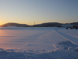
Wimberg, around Straß im Attergau ... This tour is a very abitious, you can do cross country-skiing classic or you can also walk the scating tour. Starting point: Feuerwehr Depot Pabing
further information:
- culinary interesting
- Flatly
Details - Trail
- Nordic skiing facilities: Marked Nordic skiing run
- Type of Nordic skiing run: Classic style
- free
In winter
Accessibility / arrival
Westautobahn A1, exit St. Georgen im Attergau. Drive through the centre of St. Georgen and turn left at the Vöcklamarkt - Mondsee junction in the direction of Mondsee-Straß i. A. After the village of Straß, turn right in the direction of Fronbühel and follow the signs to Mitterleiten/Feuerwehr Depot Pabing . There you can park your car and enter the cross-country trail.
Parking- Parking space: 3
- All weather
- Suitable for groups
- Suitable for schools
- Suitable for teenagers
- Suitable for seniors
- Suitable for single travelers
- Suitable for friends
- Suitable for couples
- Suitable for children
- Deep winter
Please get in touch for more information.
Attergaustraße 55
4880 St. Georgen im Attergau
Phone +43 7666 7719 - 80
E-Mail info.attergau@attersee.at
Web attersee-attergau.salzkammergut.at
https://attersee-attergau.salzkammergut.at
Interactive elevation profile
Create PDF
Tour-Details
Starting place: 4881 Straß im Attergau
Destination: 4881 Straß im Attergau
duration: 1h 12m
length: 7,3 km
Altitude difference (uphill): 133m
Altitude difference (downhill): 132m
Lowest point: 620m
Highest point: 692m
difficulty: medium
condition: medium
panoramic view: Some Views
Paths covering:
snow
powered by TOURDATA