

Oberweng Tour (R306)


- Flatly
Interactive elevation profile
Create PDF
Tour-Details
Path number: R306
Starting place: 4580 Windischgarsten
Destination: 4580 Windischgarsten
duration: 1h 44m
length: 20,3 km
Altitude difference (uphill): 469m
Altitude difference (downhill): 471m
Lowest point: 603m
Highest point: 916m
difficulty: difficult
condition: difficult
panoramic view: Dreamtour
Paths covering:
Asphalt
powered by TOURDATA
Windischgarsten - Mühlreitsiedlung - Rosenau - Berggasthof Zottensberg - Oberweng - Sonnleiten - Spital am Pyhrn - Gasthaus Kaspar - Stummerhof - Windischgarsten
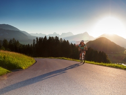
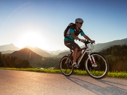
Demanding bike tour for the trained through the Garstner valley with long and steep climbs. Fantastic mountain panorama guaranteed!
The Oberwengerrunde (R306) is a real challenge in terms of fitness. The ascent from Rosenau towards Zottensberg is long and steep. When you arrive in Oberweng, however, you will be rewarded with a fantastic panorama. The shortcut to Mitterwengerrunde (R305) at around 9 kilometers saves you from climbing.
This round can also be optimally combined with the aurround (R304). However, this must then be driven in the opposite direction.
Suitable for racing bikes!
Starting point: Windischgarsten tourist office, Bahnhofstrasse 2.
Destination: Windischgarsten tourist office, Bahnhofstrasse 2.
further information:
- Flatly
- Board possible
Accessibility / arrival
Tourist office in Windischgarsten or Spital am Pyhrn.
Parking available in the town center!
- Suitable for groups
- Suitable for teenagers
- Suitable for seniors
- Suitable for single travelers
- Suitable for friends
- Suitable for couples
- Spring
- Summer
- Autumn
Please get in touch for more information.
Bahnhofstraße 2
4580 Windischgarsten
Phone +43 7562 5266
Fax machine +43 7562 5266 - 10
E-Mail info@pyhrn-priel.net
Web www.urlaubsregion-pyhrn-priel.at
http://www.urlaubsregion-pyhrn-priel.at
")
")
")
")
")
")
")
")

")
")

")


")
")
Interactive elevation profile
Create PDF
Tour-Details
Path number: R306
Starting place: 4580 Windischgarsten
Destination: 4580 Windischgarsten
duration: 1h 44m
length: 20,3 km
Altitude difference (uphill): 469m
Altitude difference (downhill): 471m
Lowest point: 603m
Highest point: 916m
difficulty: difficult
condition: difficult
panoramic view: Dreamtour
Paths covering:
Asphalt
powered by TOURDATA