

S17 Speck und Weber Runde


Interactive elevation profile
Create PDF
Tour-Details
Path number: S 17
Starting place: 4170 St. Stefan-Afiesl
Destination: 4170 St. Stefan-Afiesl
duration: 2h 19m
length: 28,4 km
Altitude difference (uphill): 545m
Altitude difference (downhill): 543m
Lowest point: 573m
Highest point: 907m
difficulty: medium
condition: medium
panoramic view: Great panorama
Paths covering:
Asphalt, Gravel, Street
powered by TOURDATA
Route:
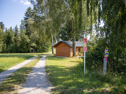
St. Stefan am Walde - Helfenberg - Altenschlag - Piberschlag - Guglwald - Afiesl -St. Stefan am Walde Marking: brown with No. S17
Map download: S17 Speck und Weber Runde
St. Stefan am Walde - Helfenberg - Altenschlag - Piberschlag - Guglwald - Afiesl -St. Stefan am Walde Marking: brown with No. S17
Map download: S17 Speck und Weber Runde
Starting point: Ortsplatz St. Stefan am Walde
Destination: Ortsplatz St. Stefan am Walde
General price information
free
Most economical season
- Spring
- Summer
- Autumn
Please get in touch for more information.
Hauptplatz 19
4190 Bad Leonfelden
Phone +43 7213 6397
E-Mail office@muehlviertlerhochland.at
Web www.muehlviertlerhochland.at/
https://www.muehlviertlerhochland.at/
Interactive elevation profile
Create PDF
Tour-Details
Path number: S 17
Starting place: 4170 St. Stefan-Afiesl
Destination: 4170 St. Stefan-Afiesl
duration: 2h 19m
length: 28,4 km
Altitude difference (uphill): 545m
Altitude difference (downhill): 543m
Lowest point: 573m
Highest point: 907m
difficulty: medium
condition: medium
panoramic view: Great panorama
Paths covering:
Asphalt, Gravel, Street
powered by TOURDATA