

Sengsengebirgs Round


- Flatly
Interactive elevation profile
Create PDF
Tour-Details
Paths covering:
Description: On the stretch between Haslersgatter and Steyrsteg, the path is partially washed out by storms, please be careful!
The storm also caused damage in the area of the Schaumbergalmstraße, great caution is required here!!!
Note from the National Park Upper Austria Kalkalpen GmbH:
Please note that due to global warming, natural events such as storms, thunderstorms with heavy rain and hail, floods or mudslides occur more frequently and that changes to the road surface or the route can occur at any time. Riding on the MTB trail network in the Kalkalpen National Park is at your own risk and responsibility. As a user, you are responsible in particular for your route selection, orientation in the area, compliance with traffic regulations, the fittings and equipment of your bike, wearing a helmet, assessing your personal ability to perform, assessing dangers and maintaining a reasonable speed. When driving in the tunnels (Hintergebirgsradweg), a head lamp or a lamp attached to the bike must be used. The national park administration excludes any kind of liability for damage caused by using the national park tour suggestions, especially for accidents.
The tour starts at the sports field in Windischgarsten, where you drive towards the town center and turn left into the Enöckl road at the bottleneck of the Purgleitner tannery.
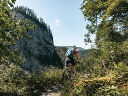
In Salzatal you drive to the Wurbauerkogel and up steeply up to Haslersgatter. From here it goes over a 2 km Singletrail Steyrsteg (part is sliding distance) in the Kalkalpen national park.
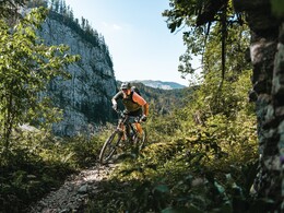
Over the Bodinggraben past the Jagahäusl further out of the valley into the Breitenau - in front of the church turn left over Reitern - Steinköpfl and down to Molln - continue over the Ramsau to the reservoir Klaus where you follow the R8 and subsequently the R31 back to Windischgarsten.
Please note that this round is not marked as MTB 12! From Windischgarsten to Haslersgatter, follow MTB 5, from here the signs Steyrsteg / Bodinggraben. In the Bodinggraben past the Jagahäusl further out of the valley into the Breitenau - before the church left up to Reitern - Steinköpfl and down to Molln - then left over the Ramsau to the reservoir in Klaus where you follow the R8 and then the R31 back to Windischgarsten.
further information:
- Flatly
details mountainbike
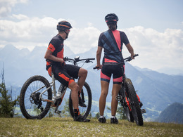
- Riding technique: difficult
Cycling and mountainbiking is allowed from April 15th to October 31st 2 hours after sunrise to 1 hour before sunset! An exception is the Langfirst mountain bike trail, where the bike season does not start until June 1st. Cycling and mountain biking is only permitted on marked routes. Some bike paths are also designated as hiking trails or bridle paths. Always count on oncoming hikers or riders!
The tour starts at the sports field in Windischgarsten, where you drive towards the town center and turn left into the Enöckl freight path at the bottleneck of the Purgleitner tannery.
- Suitable for single travelers
- Suitable for friends
- Suitable for couples
- Spring
- Summer
- Autumn
Please get in touch for more information.
Bahnhofstraße 2
4580 Windischgarsten
Phone +43 7562 5266
Fax machine +43 7562 5266 - 10
E-Mail info@pyhrn-priel.net
Web www.urlaubsregion-pyhrn-priel.at
Interactive elevation profile
Create PDF
Tour-Details
Paths covering: