

Water trail MTB11


- Suitable for families
Interactive elevation profile
Create PDF
Tour-Details
Path number: MTB 11
Starting place: 4582 Spital am Pyhrn
Destination: 4582 Spital am Pyhrn
duration: 0h 33m
length: 5,6 km
Altitude difference (uphill): 189m
Altitude difference (downhill): 39m
Lowest point: 640m
Highest point: 829m
difficulty: easy
condition: easy
panoramic view: Individual Views
Paths covering:
Asphalt, Gravel, Other
powered by TOURDATA
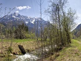
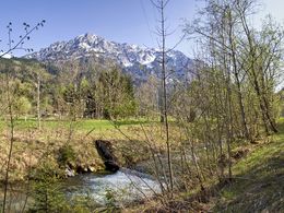
Via the water course with the mountainbike to the Wurzeralm valley station.
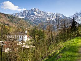
Starting point is the parking lot at the panoramic indoor pool in Spital am Pyhrn. Here you drive over the bike path through the center of Spital am Pyhrn, past the cemetery church St. Leonhard, as well as at the highway entrance to the end of the bike path.
Here you go directly after the bus stop on the right over a bridge and then turn left following the path into the forest on a gravel road.
After a few hundred meters, a detour to the pond outlet "Teichl" is worthwhile. Now it continues through an underpass and past the "Pflegerteich" before reaching the Wurzeralm funicular valley station.
Starting point: Parking lot at the indoor swimming pool in Spital am Pyhrn
Destination: Wurzeralm funicular valley station
details mountainbike
- Riding technique: medium
Cycling and mountain biking is allowed from April 15th to October 31st 2 hours after sunrise to 1 hour before sunset and is only allowed on marked routes. Some bike paths are also designated as hiking trails or riding trails. Always count on oncoming hikers or riders!
Accessibility / arrival
From the A9 motorway take the Spital am Pyhrn exit and turn left towards the center. You can park for free at the parking lot of the indoor swimming pool in Spital am Pyhrn.
- Suitable for groups
- Suitable for schools
- Suitable for teenagers
- Suitable for single travelers
- Suitable for friends
- Suitable for couples
- Suitable for children
- Spring
- Summer
- Autumn
Please get in touch for more information.

Stiftsplatz 1
4582 Spital am Pyhrn
Phone +43 7563 249
Fax machine +43 7563 249 - 20
E-Mail spital@pyhrn-priel.net
Web www.urlaubsregion-pyhrn-priel.at
https://www.urlaubsregion-pyhrn-priel.at
")
")
")

Interactive elevation profile
Create PDF
Tour-Details
Path number: MTB 11
Starting place: 4582 Spital am Pyhrn
Destination: 4582 Spital am Pyhrn
duration: 0h 33m
length: 5,6 km
Altitude difference (uphill): 189m
Altitude difference (downhill): 39m
Lowest point: 640m
Highest point: 829m
difficulty: easy
condition: easy
panoramic view: Individual Views
Paths covering:
Asphalt, Gravel, Other
powered by TOURDATA