

Mountainbike-Tour Hochplett difficult


- All weather
- Flatly
Interactive elevation profile
Create PDF
Tour-Details
Path number: S416
Starting place: 5310 Innerschwand am Mondsee
Destination: 5310 Innerschwand am Mondsee
duration: 2h 30m
length: 25,7 km
Altitude difference (uphill): 850m
Lowest point: 492m
Highest point: 1.060m
difficulty: medium
condition: medium
panoramic view: Some Views
Paths covering:
Asphalt, Gravel
powered by TOURDATA
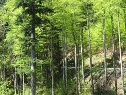
The route starts at the bus stop "Maierhof" in Innerschwand am Mondsee, about one kilometre in the direction of Unterach am Attersee away from the swimming complex Innerschwand. Immediately after the start the first crisp vertical meters are to be covered towards the village Bergen. After the wild gate begins the forest road of the Austrian Federal Forests, which provided the route.
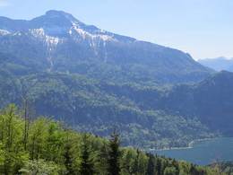
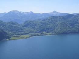
We follow the road and the signs until we can enjoy a first free view of Mondsee.
Afterwards it is possible to take the shorter of the two mountain bike trails around the Hochplett. Follow the road for the long distance, before there is a last possibility to take a short cut to the 12km long distance.
In a continuous uphill/downhill we always drive straight around the Hochplettspitze, until we reach our starting point after about 18 km of forest roads.
This difficult tour is signposted with "Hochplett 18km" - the 18km correspond to the distance of the forest roads, the access to the actual tour is not included here.
We would like to thank all the bikers for following the rules signposted at the beginning of the course and for helping to keep it open. Thank you!
further information:
- Flatly
details mountainbike
- Riding technique: medium
- All weather
- Summer
- Autumn
Please get in touch for more information.
")
Dr. Franz Müller Straße 3
5310 Innerschwand am Mondsee
Phone +43 6232 2270
E-Mail info@mondsee.at
Web www.mondsee.at
Web attersee-attergau.salzkammergut.at
http://www.mondsee.at
https://attersee-attergau.salzkammergut.at
https://attersee-attergau.salzkammergut.at
You can also visit us on
Visit us on FacebookInteractive elevation profile
Create PDF
Tour-Details
Path number: S416
Starting place: 5310 Innerschwand am Mondsee
Destination: 5310 Innerschwand am Mondsee
duration: 2h 30m
length: 25,7 km
Altitude difference (uphill): 850m
Lowest point: 492m
Highest point: 1.060m
difficulty: medium
condition: medium
panoramic view: Some Views
Paths covering:
Asphalt, Gravel
powered by TOURDATA