

Traunsee-Laudachsee-Hauergraben-Almtal


- Flatly
Interactive elevation profile
Create PDF
Tour-Details
Starting place: 4810 Gmunden
Destination: 4810 Gmunden
duration: 3h 30m
length: 38,6 km
Altitude difference (uphill): 1.097m
Altitude difference (downhill): 1.035m
Lowest point: 430m
Highest point: 1.033m
difficulty: difficult
condition: difficult
panoramic view: Great panorama
Paths covering:
Asphalt
powered by TOURDATA
Mountainbikeroute Traunsee - Almtal - Traunsee region
Starting point is the parking lot Weyer.
Grünbergbauer-Mitterweg-Radmoos-lake Laudachsee-Schrattenau-Hauergraben-connection Almtal-bycicle route-Traxenbichl
suggestion for the return journey: Almtal bycicle route-Trambach bycicle route-Halsgraben-St. Konrad-Kranichsteg-Laudachtal-Franzl im Holz-parking lot Weyer
Starting point: parking lot Weyer
Destination: parking lot Weyer
further information:
- Flatly
details mountainbike
- Riding technique: difficult
Open from April 15th to October 31st!
From November 1st to April 14th, it is not allowed to drive on the forest roads on this route, with the exception of the public roads!
Fair play in mountain biking!
")
")
")
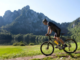
karl_heinz_ruber (8) (© Foto: TVB Traunsee-Almtal/Karl-Heinz Ruber)")
Accessibility / arrival
from the highway:departure Regau-B 145 in the direction of Bad Ischl-through the center of Gmunden-across the bridge "Traunbrücke"-turn right to the cable car "Feuerkogel"
Parking- Parking space: 200
- Parking area for disabled: 5
- Bus parking space: 7
- Suitable for teenagers
- Suitable for single travelers
- Suitable for friends
- Suitable for couples
- Summer
Please get in touch for more information.
Toscanapark 1
4810 Gmunden
Phone +43 7612 74451
E-Mail info@traunsee-almtal.at
Web www.biken.at
http://www.biken.at
Interactive elevation profile
Create PDF
Tour-Details
Starting place: 4810 Gmunden
Destination: 4810 Gmunden
duration: 3h 30m
length: 38,6 km
Altitude difference (uphill): 1.097m
Altitude difference (downhill): 1.035m
Lowest point: 430m
Highest point: 1.033m
difficulty: difficult
condition: difficult
panoramic view: Great panorama
Paths covering:
Asphalt
powered by TOURDATA