

Fahrnau - Offensee


- Flatly
Interactive elevation profile
Create PDF
Tour-Details
Starting place: 4802 Ebensee
Destination: 4802 Ebensee
duration: 3h 0m
length: 29,5 km
Altitude difference (uphill): 658m
Altitude difference (downhill): 663m
Lowest point: 424m
Highest point: 871m
difficulty: medium
condition: medium
panoramic view: Individual Views
Paths covering:
Pushing section, Gravel, Street
powered by TOURDATA
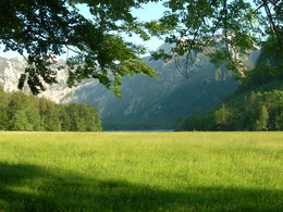
This tour leads along Rindbach Brook into the mountains east of Ebensee. At several points the valley narrows and features some gorge-like passages that offer great cycling fun! The route’s highest point is reached at Jagdhaus Fahrnau. From here you continue down to idyllic Lake Offensee. Take Offensee road back to Trauntal.
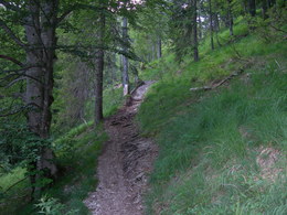
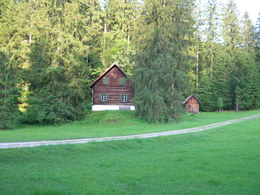
Start: Rathausplatz in Ebensee - center - across Langbathbach brook - cross the Traun after a left curve - turn left towards Rindbach after 400 meters - cross the rail tracks - ride through Rindbach - continue towards Rindbach waterfalls and the stalactite caves - after the hamlet pick up the forest trail - after the parking lot the trail climbs through the valley - wide bend at the waterfalls (well worth a visit) - continue along the forest trail - ride past the turn-off to Gassl-stalactite caves (open on weekends and bank holidays; contact the Tourist Information for details) - junction: turn left across the bridge - first right then left two beautiful hunting lodges - to Fahrnaustube (hunting lodge): continue through the forest - leave the forest trail - continue on the footpath: on foot - forest trail in the valley: towards Lake Offensee - Offensee road: left to the parking lot - around beautiful Lake Offensee (in the summer you can take a refreshing swim!) -asphalt road back to Ebensee -Lahnstein: right - underpass - road towards Roith and Ebensee -cross the rail tracks - turn-off to: starting point of the route.
Start: Rathausplatz in Ebensee - center - across Langbathbach brook - cross the Traun after a left curve - turn left towards Rindbach after 400 meters - cross the rail tracks - ride through Rindbach - continue towards Rindbach waterfalls and the stalactite caves - after the hamlet pick up the forest trail - after the parking lot the trail climbs through the valley - wide bend at the waterfalls (well worth a visit) - continue along the forest trail - ride past the turn-off to Gassl-stalactite caves (open on weekends and bank holidays; contact the Tourist Information for details) - junction: turn left across the bridge - first right then left two beautiful hunting lodges - to Fahrnaustube (hunting lodge): continue through the forest - leave the forest trail - continue on the footpath: on foot - forest trail in the valley: towards Lake Offensee - Offensee road: left to the parking lot - around beautiful Lake Offensee (in the summer you can take a refreshing swim!) -asphalt road back to Ebensee -Lahnstein: right - underpass - road towards Roith and Ebensee -cross the rail tracks - turn-off to: starting point of the route.
Starting point: Rathausplatz (town hall) in Ebensee
Destination: Rathausplatz (town hall) in Ebensee
further information:
- Flatly
details mountainbike
- Riding technique: medium


")
")
Accessibility / arrival
from the highway: departure Regau-B 145 in the direction of Bad Ischl-turn right into the center of Ebensee
Most economical season
- Spring
- Summer
- Autumn
Please get in touch for more information.
4802 Ebensee
Phone +43 6133 8016
E-Mail ebensee@traunsee-almtal.at
Web www.traunsee-almtal.at/ebensee
http://www.traunsee-almtal.at/ebensee
Interactive elevation profile
Create PDF
Tour-Details
Starting place: 4802 Ebensee
Destination: 4802 Ebensee
duration: 3h 0m
length: 29,5 km
Altitude difference (uphill): 658m
Altitude difference (downhill): 663m
Lowest point: 424m
Highest point: 871m
difficulty: medium
condition: medium
panoramic view: Individual Views
Paths covering:
Pushing section, Gravel, Street
powered by TOURDATA