

road Laudachseestraße in Gmunden


Interactive elevation profile
Create PDF
Tour-Details
Starting place: 4810 Gmunden
Destination: 4810 Gmunden
duration: 1h 28m
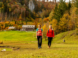
length: 3,8 km
Altitude difference (uphill): 303m
Altitude difference (downhill): 21m
Lowest point: 618m
Highest point: 910m
difficulty: easy
condition: easy
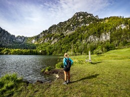
panoramic view: Great panorama
Paths covering:
Asphalt, Hiking trail
powered by TOURDATA
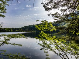
The best starting point is Franzl im Holz. Kohlbachweg downhill-till in front of a bridge- turn right into the road "In der Klamm"- forest road uphill-after one hour you reach the "Wameringweg"-lake Laudachsee
Starting point: Franzl im Holz
Destination: lake Laudachsee/Grünberg
")
karl_heinz_ruber (8) (© Foto: TVB Traunsee-Almtal/Karl-Heinz Ruber)")
Accessibility / arrival
from the highway: departure Regau-B 145 in the direction of Bad Ischl-through the center of Gmunden-across the bridge "Traunbrücke"-traffic circle-first exit-in front of the Gasthaus Engelhof turn right-follow the road till Franzl im Holz
Most economical season
- Summer
Please get in touch for more information.
Toscanapark 1
4810 Gmunden
Phone +43 7612 74451
E-Mail info@traunsee-almtal.at
Web www.traunsee-almtal.at
http://www.traunsee-almtal.at
Interactive elevation profile
Create PDF
Tour-Details
Starting place: 4810 Gmunden
Destination: 4810 Gmunden
duration: 1h 28m
length: 3,8 km
Altitude difference (uphill): 303m
Altitude difference (downhill): 21m
Lowest point: 618m
Highest point: 910m
difficulty: easy
condition: easy
panoramic view: Great panorama
Paths covering:
Asphalt, Hiking trail
powered by TOURDATA