

V8 Schönegger round


- Suitable for families
- Suitable for kids (all ages)
- culinary interesting
- culturally interesting
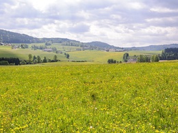
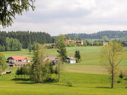
- Flatly
- Possible accommodation
Interactive elevation profile
Create PDF
Tour-Details
Path number: V8
Starting place: 4191 Vorderweißenbach
Destination: 4191 Vorderweißenbach
duration: 3h 0m
length: 12,6 km
Altitude difference (uphill): 316m
Altitude difference (downhill): 320m
Lowest point: 654m
Highest point: 825m
difficulty: medium
condition: medium
panoramic view: Some Views
Paths covering:
Asphalt, Gravel, Hiking trail
powered by TOURDATA
Route:
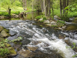
Hotel Guglwald - Steinerne Mühl - Waldkapelle Maria Rast - Hotel Guglwald
Hotel Guglwald - Steinerne Mühl - Waldkapelle Maria Rast - Hotel Guglwald
Starting point: Hotel Guglwald
Destination: Hotel Guglwald
further information:
- culinary interesting
- Flatly
- Possible accommodation
- Board possible
General price information
free
- Suitable for groups
- Suitable for schools
- Suitable for kids (all ages)
- Suitable for single travelers
- Suitable for friends
- Suitable for couples
- Suitable for children
- Spring
- Summer
- Autumn
Please get in touch for more information.
Hauptplatz 19
4190 Bad Leonfelden
Phone +43 7213 6397
Fax machine +43 7213 6397 - 13
E-Mail office@muehlviertlerhochland.at
Web www.muehlviertlerhochland.at
https://www.muehlviertlerhochland.at
")
")
")
")
")
Interactive elevation profile
Create PDF
Tour-Details
Path number: V8
Starting place: 4191 Vorderweißenbach
Destination: 4191 Vorderweißenbach
duration: 3h 0m
length: 12,6 km
Altitude difference (uphill): 316m
Altitude difference (downhill): 320m
Lowest point: 654m
Highest point: 825m
difficulty: medium
condition: medium
panoramic view: Some Views
Paths covering:
Asphalt, Gravel, Hiking trail
powered by TOURDATA